The Permanent Collection · The Pioneers of Modern Graphics
Galton's Weather Map
Francis Galton, 1875
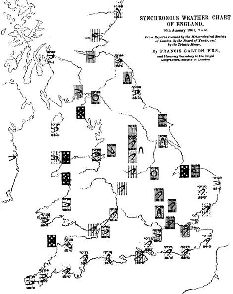
Before Francis Galton came along, there was no such thing as a weather map in a newspaper. Galton, a polymath cousin of Charles Darwin, changed that in 1875 when he published the first modern weather map in The Times of London. But the path to that map was years in the making. Galton had been fascinated by meteorology since the 1850s, and he undertook a massive data collection effort, gathering simultaneous weather observations from more than 80 stations across Europe. He then plotted this data — wind direction, barometric pressure, rainfall, and temperature — onto maps and began looking for large-scale patterns. What he discovered was groundbreaking: he identified and named the 'anticyclone,' a large-scale pattern of clockwise-rotating high-pressure air that brings calm, clear weather, the counterpart to the already-known cyclone. His map in The Times brought all of this together for a general audience, showing readers for the first time how weather systems moved across a continent in a single visual. Galton essentially pioneered meteorological visualization and laid the groundwork for the weather maps and forecasts that billions of people check every single day. The next time you glance at a weather app on your phone, you're looking at a direct descendant of what Galton started in 1875.
weather map · meteorology · anticyclone · newspaper · Europe